Projects
Determining the likelihood of ship-source hazardous and noxious substance releases in Canada – Fredericton, NB
This project required the review of previously completed international HNS Risk Assessments studies including their methodologies and identified best practices as well as a review of over 14 international collision and accident databases. These were then utilized to develop a methodology to be applied to the Canadian context. The Canadian study required analyzing quantitative data such as three years of historical AIS data and the Statistics Canada Commodity Database to determine quantities and types of goods shipped in Canada. The Commodity Database provides all goods and services imported and exported in Canada by all means (truck, train, vessel, airplane and pipeline) and therefore a statistical analysis was completed on the Commodity Database to determine types and volumes of HNS and other goods moved by vessel in each region of Canada.
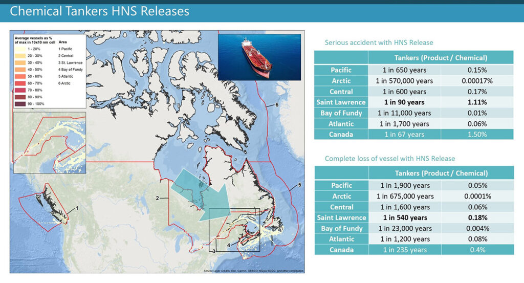
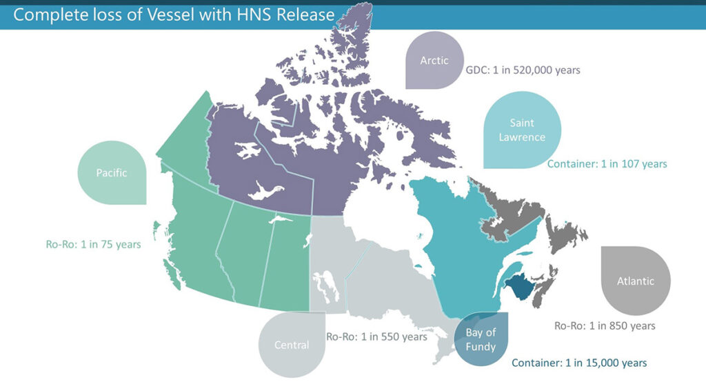
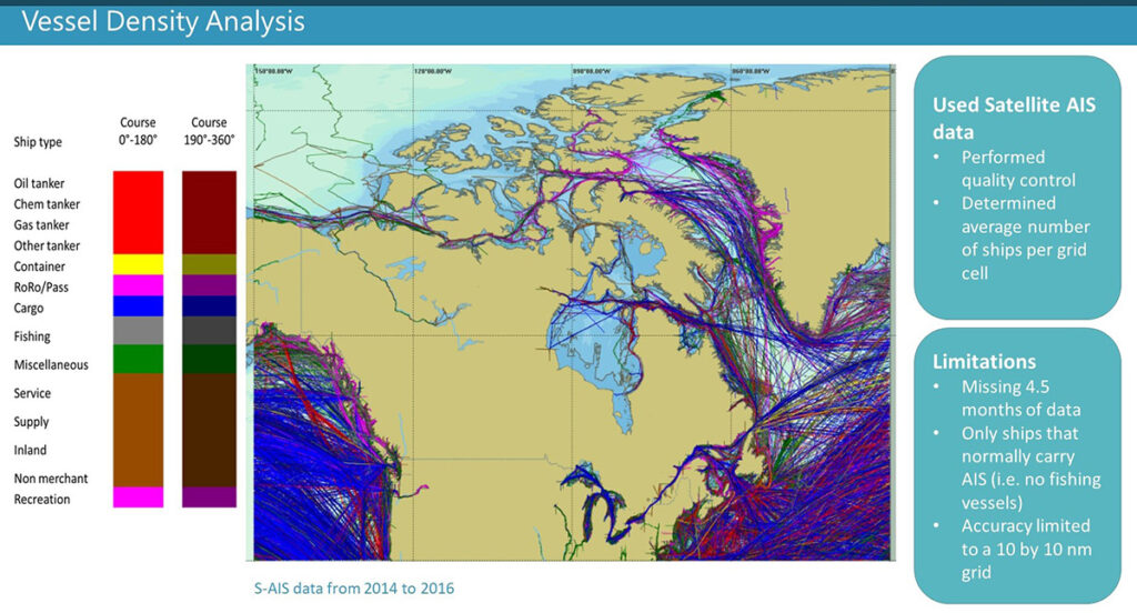
Dillon also completed a gap analysis to identify areas where further data could be collected by the government for future studies. Satellite Automatic Identification System (S-AIS) data obtained for the years 2014 to 2016 was used to build a traffic database for Canadian waters, including ship type, route, and nautical miles sailed. Canadian waters were divided into six regions with similar geographic characteristics to enable the calculation of vessel traffic density, accident rates, and HNS cargo volume estimations. From this analysis, the likelihood of an accident with the potential to result in the release of HNS was calculated, for each region of Canadian waters, including the Arctic, using the Information Handling Services (IHS) Fairplay database and the Safety Assessment Model for Shipping and Offshore on the North Sea (SAMSON) model. Only vessels greater than 100 gross tonnes were included in the analysis due to a limitation of the IHS Fairplay database and the SAMSON model.
Awards
- Pinnacle Award, The Association of Consulting Engineering Companies – New Brunswick, 2020
Project Details
Project Partner: Transport Canada
Business Unit: Contaminated Sites Management
Service Offering: Disaster and Emergency Response