Projects
Crown Land Aggregate Quarry Liability Assessment – MB
The Government of Manitoba retained Dillon to undertake an assessment of aggregate quarries and pits on Crown Lands in Manitoba and support them in redesigning the Quarry Rehabilitation Program.
The project focused on addressing the rehabilitation of pits/quarries on Crown Lands, and providing both Manitoba Agriculture and Resource Development (MARD) and the Office of the Provincial Comptroller (OPC) with an estimate of the asset rehabilitation liabilities for these quarries and pits.
Dillon’s engineering work as part of this assignment included:
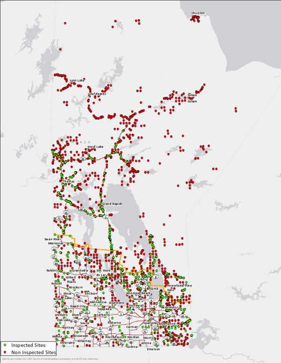
- Development of an inventory system for over 2,700 pits and quarries on Crown Lands, utilizing information from a number of different systems/databases in the Province
- Assessment of the pits and quarries in the inventory and development of a methodology to categorize them according to site type (quarry or pit), size, location and potential rehabilitation requirements for either final or progressive rehabilitation
- Assessment of the risk and cost of the associated rehabilitation requirements, based on their categorization, including safety and environmental factors
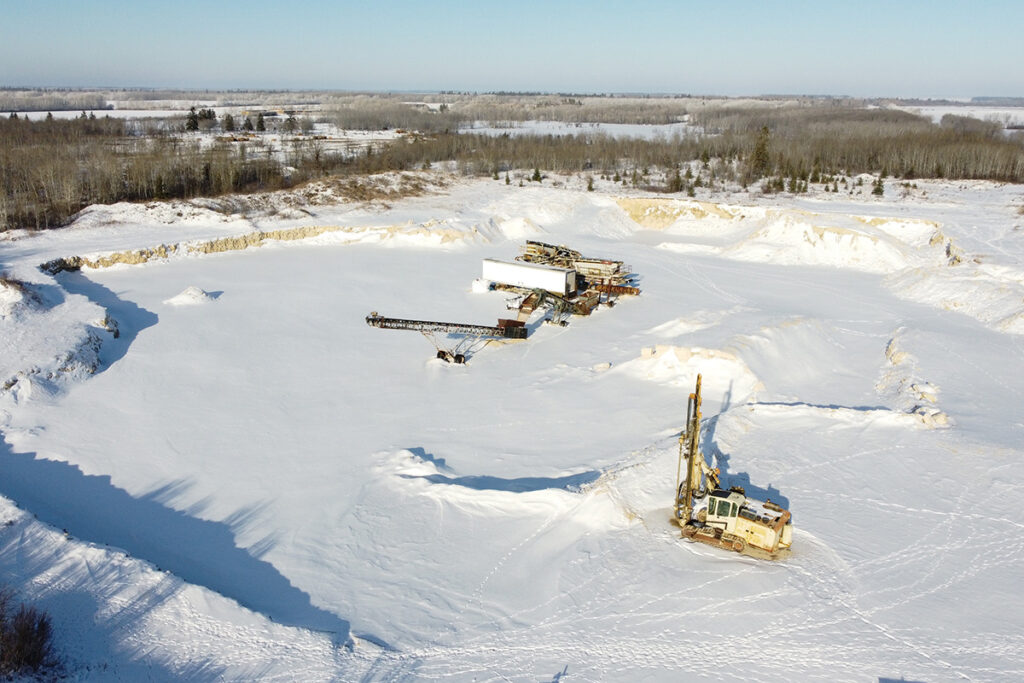
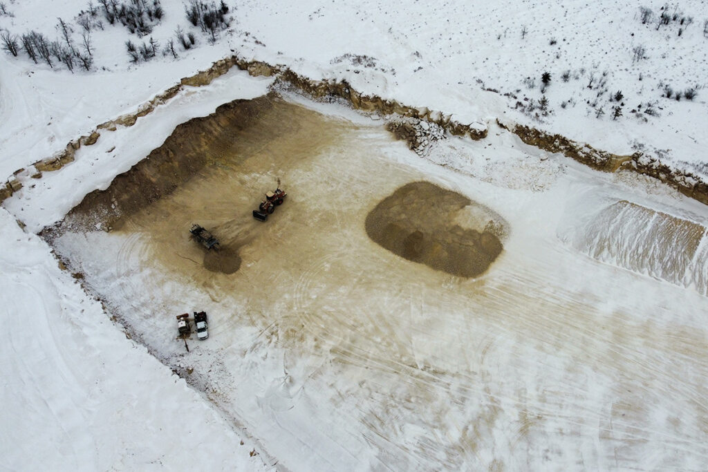
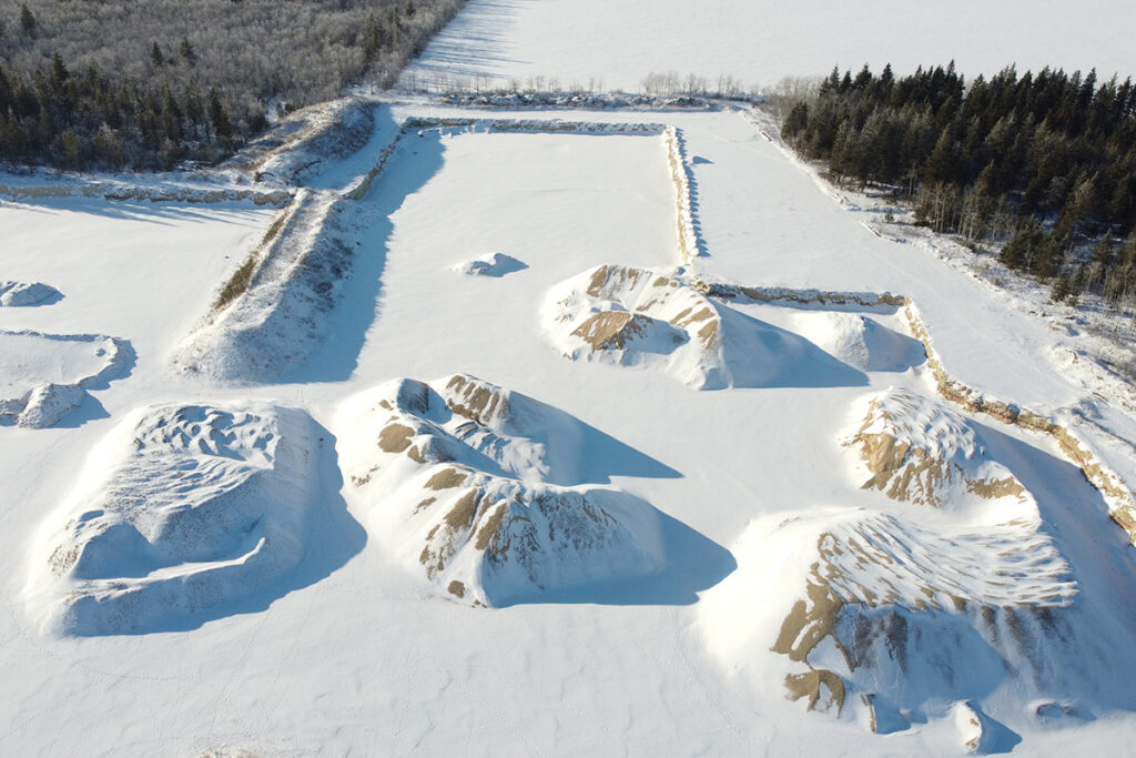
- Site inspections by an experienced team with knowledge of heavy construction and pit rehabilitation, including the use of drone technology to acquire real-time imagery of the pits and quarries
- Initial estimates of the total rehabilitation liability for MARD and OPC
- Development of a framework for the future management of Manitoba’s pits and quarries on Crown lands.
Our report, which included a total existing liability estimate and associated work, was very well received by the client. Significant effort across multiple engineering disciplines was required for its successful delivery. Dillon is also currently providing the Province with additional services as part of our continued partnership to manage these major assets moving forward.
Awards
- Association of Consulting Engineering Companies Manitoba, Environmental Award – 2023
Project Details
Project Partner: Government of Manitoba
Business Unit: Environmental Management
Service Offering: Environmental Compliance and Risk