Projects
Long Term Impacts of Climate Change on the New Brunswick Transportation Network – NB
Dillon was retained by the New Brunswick Department of Transportation and Infrastructure (NBDTI) to prioritize and identify roads on the transportation network vulnerable to climate change. Dillon’s scope included identifying roads vulnerable to flooding, leading a stakeholder engagement session, ranking and prioritizing the identified flooded sections, and preparing mitigation summary reports for high priority sites.
The project was completed by overlaying the Flood Hazard Maps for the 2100 Flood with Climate Change for the 1 in 100 year (1% Annual Exceedance Probability (AEP)) and the 1 in 20 year (5% AEP) events onto the NBDTI transportation network to identify flooded roadway segments. The GIS analysis produced a list of over 1,000 road sections and the Dillon GIS team calculated various flood risk attributes. This included length of sections that could potentially flood, average depth of water for flooded sections, and which roads were impacted by the flood scenarios.
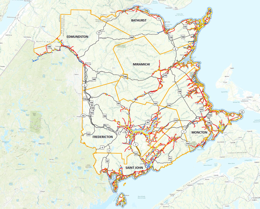
In order to rank the vulnerable infrastructure, a priority matrix was developed with input from NBDTI staff from various departments during a stakeholder engagement session led by Dillon. After a review of several matrix scoring criteria options, the top five criteria were identified, and ArcMap was used to complete the analysis of over 1,000 road sections, gather the results, and associate the correct score. The full list of sites, sorted in ranking groups from 1 (highest) to 5 (lowest) based on their priority score, was sent to the client for an internal review process to select 15 priority feasible projects covering a range of vulnerable road classes and capital costs. Dillon then developed Class D cost estimates and project scope descriptions for the top 15 priority sites.
Project Details
Project Partner: Province of New Brunswick
Business Unit: Community Planning & Infrastructure
Service Offering: Drainage and Climate