Projects
Conceptual Subdivision Layout and Walking Trail Network – Natoaganeg First Nation, NB
The Natoaganeg First Nation retained Dillon to complete a conceptual design for a Future Subdivision and Walking Trail Network, which included workshops with Community staff and leadership, conceptual site layout plans, engineering and environmental considerations, as well as a suggested phasing plan based on funding availability.
Dillon worked collaboratively with the Natoaganeg First Nation to complete a conceptual subdivision layout complete with walking trails for an undeveloped parcel of land within the northern portion of the community. The purpose of this conceptual subdivision layout was to develop a plan to address the growing housing backlog list, while also meeting other growth initiatives in the community, such as identification of economic development areas in line with the community’s strategic economic development plan, as well as inclusion of green spaces, walking trails, and snowmobile and ATV trails.
Dillon provided the following professional services as part of this project:
- Project management;
- Background review, including two workshops with community staff and leadership. Workshops also included input from Elder groups;
- Conceptual site development in the form of a 30% and 60% conceptual design, including engineer and environmental constraints identified as part of the background review; and,
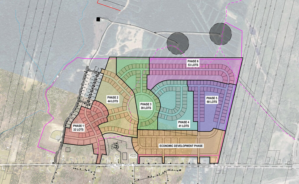
- Final conceptual design, including a report of findings, phasing plan, and an opinion of probable cost for the development.
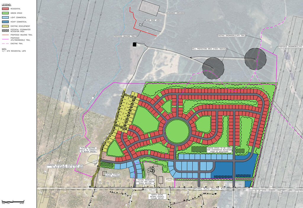
The final conceptual subdivision plan was developed in consideration of meeting a growing community need while embracing the region’s existing stock of greenspaces, and culturally significant items and points of interest. By integrating and building on these features, the final conceptual design aimed to serve as an extension of the southern part of the community, preserve important connectivity throughout the community while sustaining adherence to funding guideline requirements in a creative manner that resonates with the community. The proposed development along with its walking trail network and economic development area will benefit the community in several ways, such as:
- Reducing the demand of on-reserve housing with the addition of 269 residential lots;
- Providing continuity of greenspaces throughout the development to encourage social and environmental benefits to community members;
- Expanding available economic development areas along Micmac Road as per the community’s economic development strategy with the addition of 34 light commercial lots; and,
- Introducing heavy industrial areas for the community to explore as a revenue generation source.
Project Details
Project Partner: North Shore Micmac District Council
Business Unit: Land Development
Service Offering: Civil Engineering Design and Construction