Projects
Community Flood Assessment – Nahanni Butte, NT
Dillon supported the Nahanni Butte Dene Band (NBDB) to address the increasing risks of flooding and erosion within the community. This effort aims to enhance community understanding of these hazards, develop effective mitigation strategies, and produce regulatory flood hazard maps to inform land use planning and improve overall community safety now and in a changing climate. This project has been supported by funding from the Climate Change Preparedness in the North (CCPN) program and the Federal Flood Hazard Identification and Mapping Program (FHIMP).
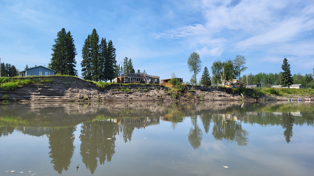
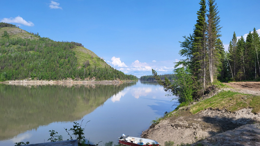
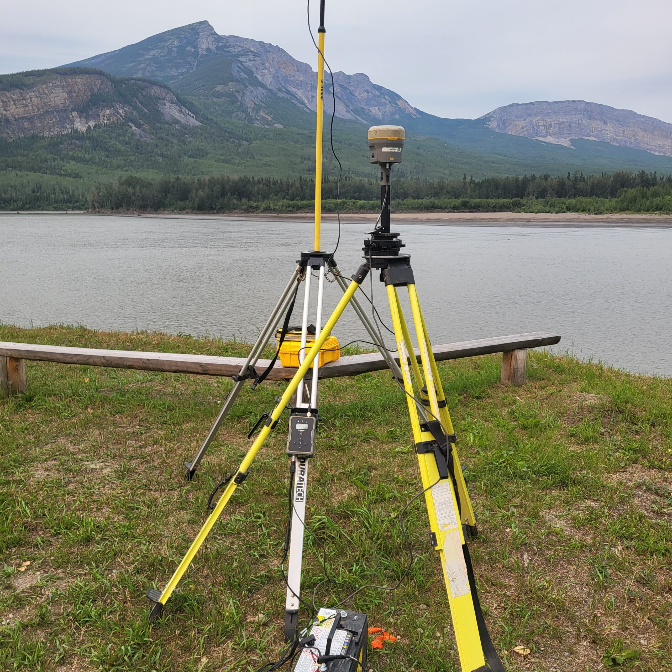
This project was informed by a blend of local knowledge, extensive data collection, and technical assessments. Community engagement, including input from Traditional Knowledge holders and observations from community members, provided insights into historical flooding and erosion patterns. A community-led monitoring program involved weekly visual assessments of shoreline changes on the South Nahanni River, contributing to a detailed understanding of water level fluctuations. Desktop data collection encompassed existing geospatial data and analysis of historical hydrometric data from regional stations. On-site observations were completed in 2024 to understand the bathymetry of the South Nahanni and Liard rivers, surveying 15 linear km of river bathymetry. A drone survey further enhanced Dillon’s topographic understanding of the community and nearshore area, which had become exposed due to low water levels at the time.
Building upon this foundational work, flood mapping was completed by undertaking a detailed hydrologic and hydraulic modelling initiative. This involved the use of a physically-based Raven hydrologic model for the Liard and Nahanni Rivers to simulate watershed processes under both current and future climate conditions. A detailed climate change sensitivity analysis utilized downscaled climate projections to represent flood hazard in a changing climate, suggesting a potential for increased snowpack and higher annual peak flows in this snowmelt-driven environment. The hydraulic assessment was conducted using a HEC-RAS two-dimensional (2-D) model to account for the overland flow and backwater effects at the confluence of the South Nahanni and Liard Rivers.
Dillon worked closely with Environment and Climate Change Canada (ECCC), Natural Resources Canada (NRCan), and the Government of the Northwest Territories (GNWT) as regulators to decide how to quantify flood hazards and climate change impacts. Regulatory flood maps have been produced, including a flood inundation map for the 2012 flood and four flood hazard maps: historical 1% and 0.5% AEP events, and two climate change scenarios. The maps delineate floodway and flood fringe areas, with the floodway primarily defined by water depth greater than 1 meter in Nahanni Butte. Few areas within the community are expected to be entirely outside the flood fringe.
Flood inundation maps indicated that a significant portion of the community is subject to some amount of inundation, which is consistent with community observations. The flood assessment included an erosion assessment of the riverbank, which revealed an approximate erosion rate of 1.0 meter per year, which is important to consider in planning and mitigation considerations. The community has already implemented proactive measures such as minimum building heights and new construction on higher ground.
The combined findings have informed a comprehensive Flood and Erosion Action Plan, integrating both structural and non-structural measures in alignment with federal emergency management principles.
Through proactive planning and sustained collaboration, the Nahanni Butte Flood and Erosion Action Plan aims to secure a safer future for its residents and protect the community for generations to come.
Project Details
Project Partner: Nahanni Butte Dene Band
Business Unit: Community Planning & Infrastructure
Service Offering: Drainage and Climate