Projects
Baseline Risk Assessment of Land Development Within Proximity of Freight Rail Corridors – Calgary, AB
After the catastrophic train derailment that took place in Lac-Mégantic in 2013, which claimed 47 lives, the issue of rail proximity safety was brought to the forefront for Canadian municipalities. The City of Calgary reached out to Dillon to develop a method to assess the risks so that future development could take place while protecting public safety.
Rail lines are in every quadrant of the City of Calgary including the downtown core. In order to find a solution for safe development, several topics were looked at:
- Municipal planning
- Emergency preparedness within the City
- Structural integrity of buildings adjacent to rail lines
- Noise and vibrations caused by rail and its impact on buildings
- A deep analysis of incident and traffic data to answer the questions ‘what should be acceptable’ and ‘what is safe development’.
Dillon worked closely with the City, holding internal and external engagement sessions. With these sessions, we discovered one solution that could be applied to the entire city – a standardized, systematic and transparent methodology called the Baseline Risk Assessment (BRA). The BRA was incorporated within a web app that the public, developers, and the planning department could all get live risk assessments by clicking on a parcel of land, and was the first of its kind to be developed in Canada.
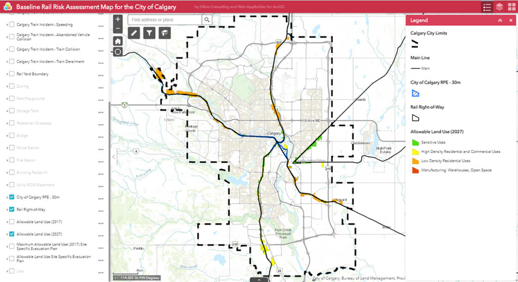
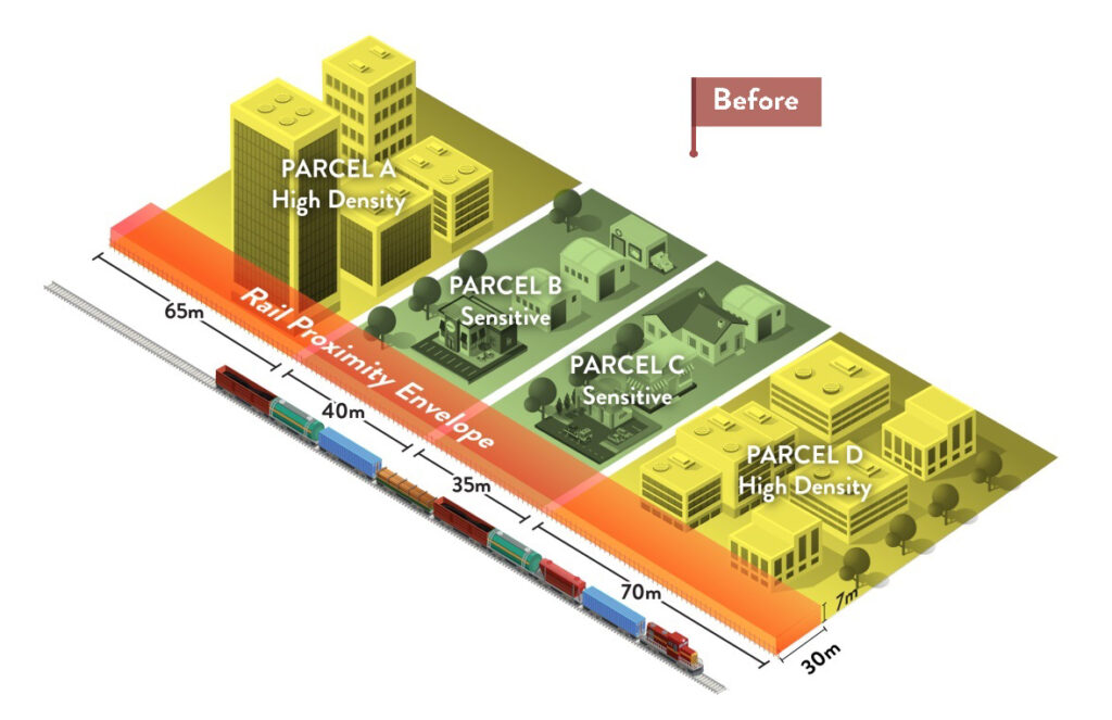
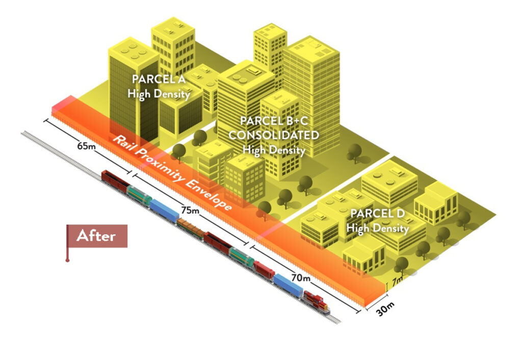
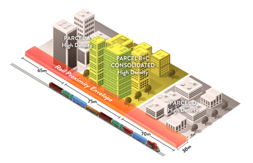
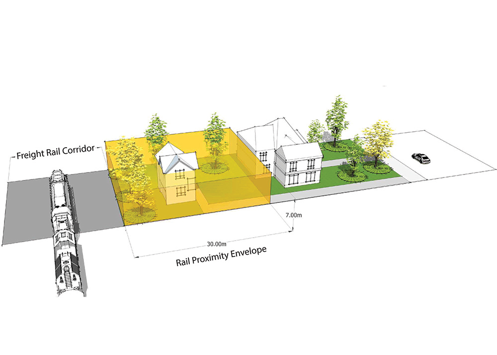
By conducting statistical analysis and data correlations between historical Transportation Safety Board of Canada (TSB) freight rail accidents across Canada, historical freight rail traffic, and local site conditions, and cross-referencing them with historical freight train derailment studies completed in the United States, Dillon was able to come up with an innovative means to measure the risk of a moving hazard called the Rail Proximity Envelope (RPE). The RPE allowed Dillon to estimate the level of exposure to adjacent lands based on the width and depth of the parcel and the height associated with any buildings to determine how many floors would be at risk. Using geo-spatial analysis, the size of the RPE can be customized to be either larger or smaller, depending on the local topography for each parcel of land. With this information, Dillon now has the opportunity to offer a subscription-based service using anArc-GIS platform.
The BRA informed the City of Calgary’s new Development Next to Freight Rail Corridor Policy that allows development to occur closer to rail lines. It is anticipated that in over 90% of parcels along freight rail corridors in the City, developers can manage the risks through configuration of the buildings and occupancy, avoiding the need for expensive crash walls or other physical barriers to protect building occupants within 30 m of the freight rail corridor.s. Both the web app and the new policy are endorsed by Canadian Pacific and BILDCalgary.
Awards
- Award of Excellence for Safety Innovation, Alberta Minister’s Awards for Transportation Innovation, 2019
Project Details
Project Partner: City of Calgary
Business Unit: Transportation
Service Offering: Transit