Projects
Back to the River: Forest City, River City – London, ON
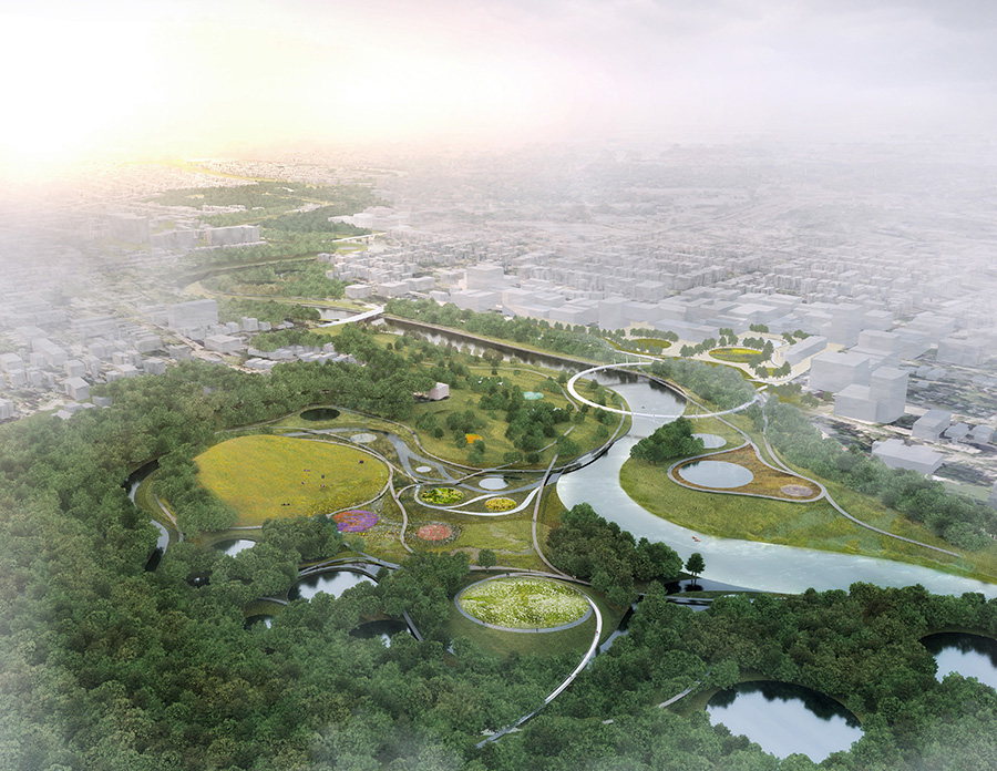
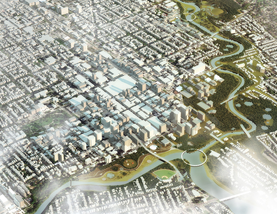
The Thames River Valley is the most prominent geomorphic feature in London, ON with the confluence of two branches into a third at the Forks. A Canadian Heritage River, it makes outstanding contributions to cultural heritage, natural heritage and recreation. The Thames plays a central role in defining the social, cultural, civic and economic possibilities for London’s residents, workers and visitors. The City is experiencing a confluence of planning opportunities that will catalyze transformational changes in the fabric of London, making this the most opportune time to come Back to the River.
In partnership with Stoss, Dillon was a design finalist for the community mobilization initiative to revitalize a 5km stretch of the river. Given the sensitivity of the river environment, and the challenges of flood mitigation, we proposed a strategy to build on the characteristics of existing natural and social environments. The design focused on the following:
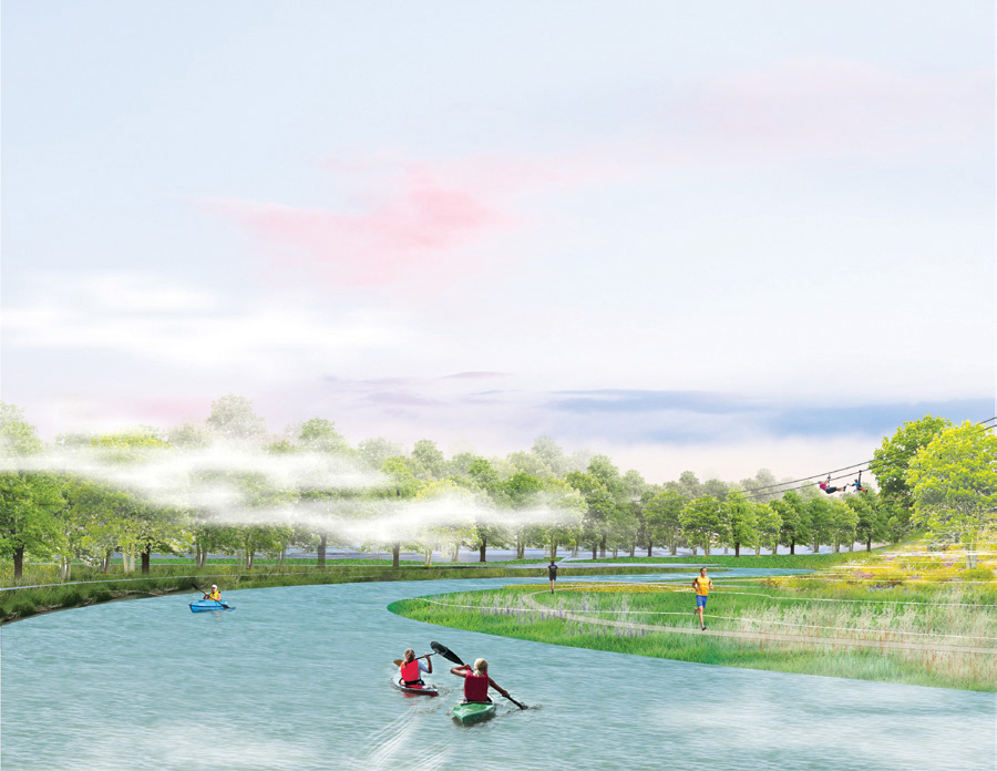
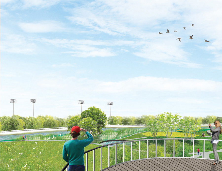
- Enhancing Carolinian plant communities with a biologically diverse landscape restoration of woodlands, wetlands and meadows to build diversity and sustainability of the urban forest.
- Expanding flood capacity wherever possible recognizing that the North Branch and South Branch have differing hydrologic characteristics and use science as the basis for informing where to implement aquatic and terrestrial restoration strategies.
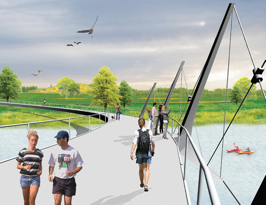
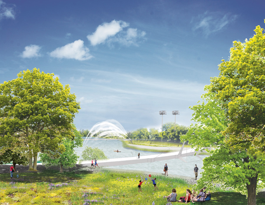
- Interconnecting neighbourhoods to the table and trails system with new access points, promontories and bridges that visually punctuate and span the valley to thread together the network of valleyland parks, natural greenspaces, river’s edge access and passive recreational amenities.
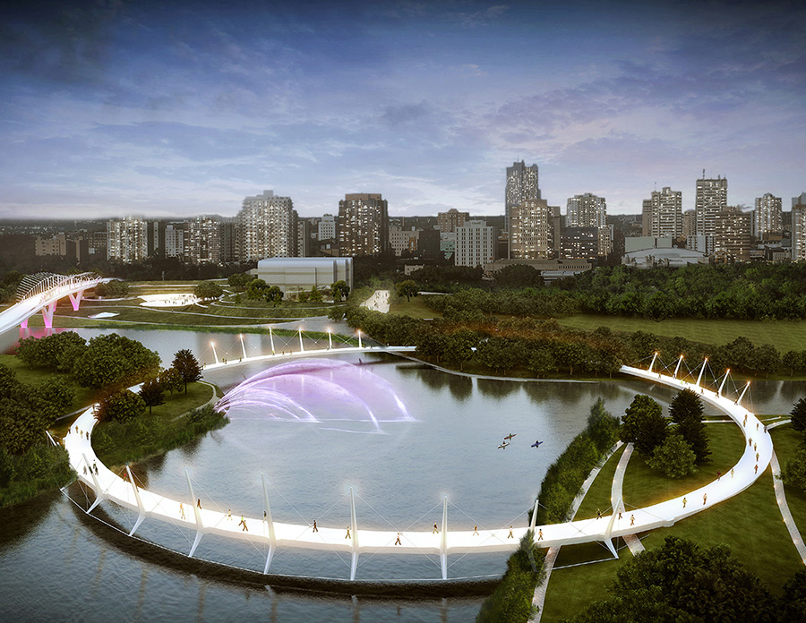
- Recommended a multi-modal bridge, supporting vehicles, transit, and cycling lanes, while also incorporating a circular pedestrian bridge, connecting to all three branches of the Thames River
- Untying the knot of transportation infrastructure by replacing the Queens Avenue bridge with a multi-modal bridge supporting vehicles, transit (LRT or BRT) and separated cycling facilities that have capacity to support London’s transportation needs into 2035.
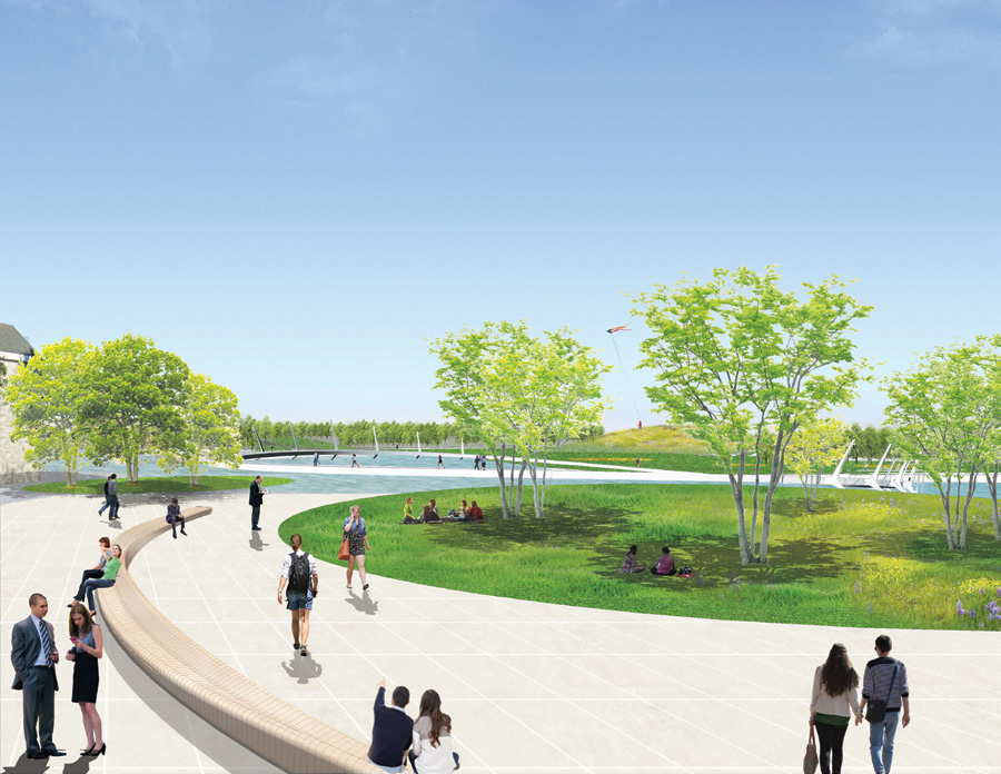
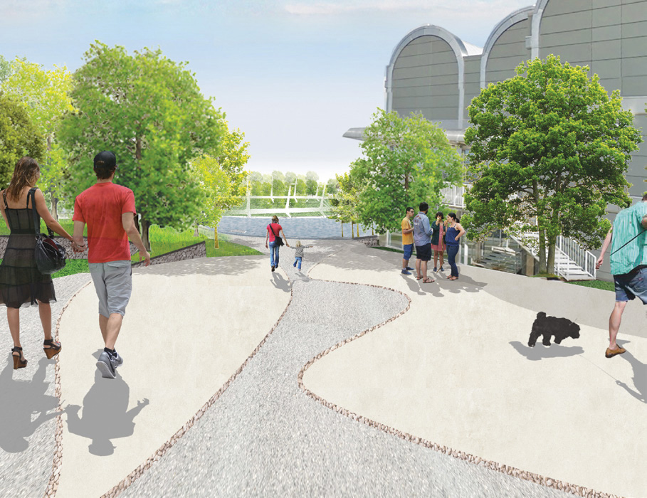
- Intensifying the uses where Dundas Street meets the River with four seasons programming of a new civic terrace that embraces Museum London, the shoreline at the Forks and Harris Park and create a new iconic circular pedestrian connection across all three branches of the Thames at the Forks and from SoHo to Watson Park.
- Protecting heritage buildings, facilitate all season use, enable use by all abilities; interpret First Nations, European settlement and industrialization during London’s growth.
- Encouraging the redevelopment of mixed use, transit oriented, sustainable land uses in the neighbourhoods abutting the River and on brownfield sites along the corridor including: the LaFarge lands; Downtown, Hydro London lands and Soho Neighbourhood.
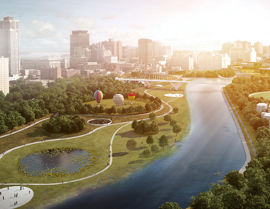
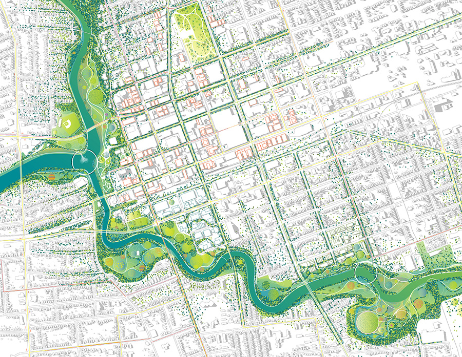
The plan was designed to be comprehensive and bold, the vision is one that is expected to be implemented over a 20-year horizon with two inaugural projects in the key spaces of The Forks and SoHo Neighbourhood.
Project Details
Project Partner: City of London
Business Unit: Community Planning & Infrastructure
Service Offering: Community Planning